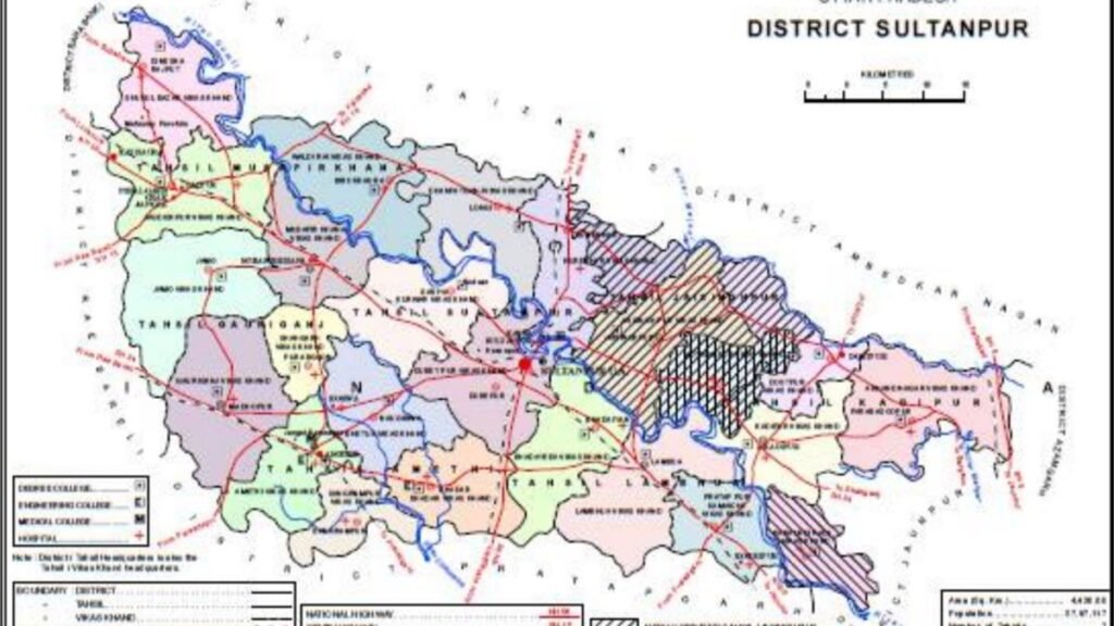
The official website of Sultanpur district, in Uttar Pradesh, places the town on the Gomti and gives a compact account of how the settlement changed banks and names. According to that portal, the original town stood on the left bank of the river. Tradition, as recorded there, says it was founded by Kusa, the son of Rama, and was known as Kusapura or Kusabhavanpur. The present city, which gives the district its name, stands on the right bank. Reading the official page carefully helps separate tradition, later medieval stories and the nineteenth century shift of the town.
The same official introduction records that General Cunningham identified this ancient city with the Kusapur mentioned by the Chinese traveller Xuanzang, whose name also appears in older books as Hiuen Tsang. The portal states that in the traveller’s time there was a dilapidated stupa of Ashoka, and that the Buddha taught here for six months. Buddhist remains are said to be visible at Mahmoodpur, a village about 8 km to the north west of Sultanpur, according to the same page. These are claims presented in the district’s own history text, not a new excavation report.
From Kusabhavanpur to the name Sultanpur
The official narrative then moves to later centuries. It says the town fell into the hands of the Bhars, and was taken from them by Muslim rulers in the twelfth century. A story recorded on the portal tells of two horse dealers, Sayid Muhammad and Sayid Ala ud Din, and a later campaign associated with Ala ud Din Khilji, after which Kusabhavanpur was destroyed and a town called Sultanpur rose on its ruins, a name linked to the rank of the victor. Readers should treat this as the traditional account published by the district, and look to gazetteers if they want the older wording in full.
The district history page also leans on the Sultanpur gazetteer published in 1903 for landholding families of that era, including Rajput clans such as the Rajkumars, Bachgotis and others, with percentage shares of land as printed in that colonial gazetteer. Those figures describe a past agrarian order. They are not a census of today’s population. The page also recalls later participation in the freedom movement, and names peasant leaders such as Baba Ram Chandra and Baba Ram Lal, with a reference to Jawaharlal Nehru’s autobiography. For that political strand, the official history page is the starting point.
Why the town now stands on the right bank
The official city profile says the older town was razed during military operations connected with the reoccupation of the province, after inhabitants were accused of involvement in the killing of British officers at the outbreak of the 1857 struggle. Before annexation, a military station and cantonment had been set up on the right bank, in a village then known as Girghit, also called Chhaoni Sarkar by officials and Kampu, or the Camp, by local people. The present town developed at that site. This is why a visitor looking for the oldest riverbank memory and the present bazaar may be looking at two sides of the Gomti.
The official introduction also lists later civic landmarks: two parks, the Vinayak Mehta library, a clock tower in the Chowk, Christ Church in Civil Lines, said to have been opened and consecrated on 16 November 1869, and Victoria Manzil, built to mark a jubilee of Queen Victoria. On the bank of the Gomti is Sitakund, which the portal describes as the place where Sita bathed while accompanying Rama in exile. That is a living tradition beside the administrative town that grew from the cantonment.
How to read this history today
Official district pages are useful because they are public and citable, but they also summarise older books in short paragraphs. Spellings of names vary. Neighbouring districts have changed, including the later creation of Amethi, so old maps and new maps should not be mixed casually. A well known bird sanctuary of the same name, Sultanpur, stands in Haryana, near Gurugram. It is not this district. Searchers should add Uttar Pradesh to the name.
If you visit, use the river, the district museum if open, and the official portal for notices, rather than unverified social media timelines that invent exact founding years. Sitakund is a place of faith. Kusabhavanpur is a historical identification discussed in official and gazetteer literature. The cantonment story explains the modern street plan on the right bank. Holding these layers apart is the most honest way to tell Sultanpur’s past.
In short, the official Sultanpur district site traces a path from a left bank settlement remembered as Kusabhavanpur, through later medieval change and the destruction around 1857, to the present town on the right bank of the Gomti. It also records Sitakund and a few colonial era civic buildings. This article follows that official account, without adding dates or numbers that the portal does not clearly support. For further reading, start at sultanpur.nic.in and the history page linked from it.
Also Read: DigiLocker Guide: How to Download Aadhaar, PAN, Driving Licence and Marksheets Legally Valid
Source: District Sultanpur official portal, History, District Sultanpur